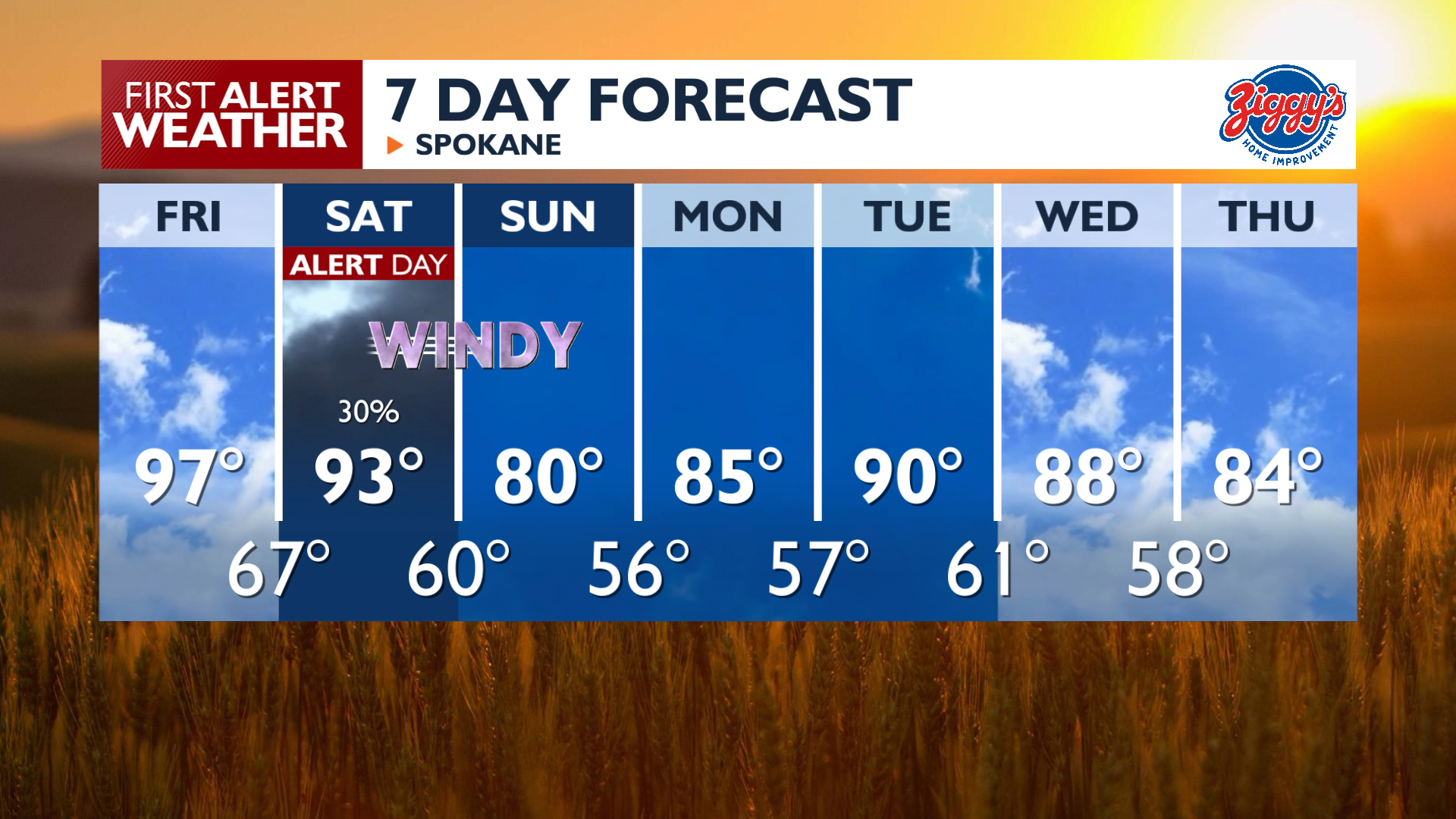
Friday brings widespread heat as temperatures climb into the mid to upper 90s, with a few locations potentially reaching 100 degrees. Expect filtered sunshine through increasing middle and high-level clouds with light winds that won’t provide much cooling on your skin.
A system arriving Saturday increases the threat of thunderstorms and gusty winds between 30 and 35 mph. These conditions combined with dry air will lead to critical fire weather concerns across the Inland Northwest before temperatures cool into the 80s on Sunday. Saturday afternoon is the most critical time for fire weather conditions as we’ll have the gustiest winds along with lightning strikes at the same time from developing thunderstorms. Saturday is a 4 News Now Weather Alert Day.
Sunday will be significantly cooler with highs in the 70s and 80s, which will lower the fire danger significantly compared to the 90s the day prior.
COPYRIGHT 2026 BY KXLY. ALL RIGHTS RESERVED. THIS MATERIAL MAY NOT BE PUBLISHED, BROADCAST, REWRITTEN OR REDISTRIBUTED.