Tuesday is a 4 News Now Weather Alert Day. The forecast today brings strong winds and low humidity, creating hazardous travel and a high risk for fast-spreading wildfires.
Plan Your Tuesday
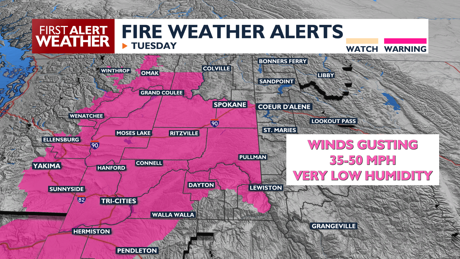
A strong cold front moves through the area on Tuesday afternoon, bringing wind gusts between 30 and 50 mph. These winds will be strongest from noon until 9 PM Tuesday. High temperatures will reach the mid 80s to low 90s with very low humidity. There is a Fire Weather Warning in effect this afternoon.
Expect blowing dust and difficult travel for high-profile vehicles from the Washington-Idaho State Line to the foot of the Cascade Mountains. A Wind Advisory is in effect for the I-90 corridor in Eastern Washington. Blowing dust is most likely around Spokane and Coeur d’Alene after 2 p.m.
It is extremely important to practice good fire safety today. Even this early in the fire season, winds like this could fan the flames of a blaze faster than firefighters can get control of it.
What We’re Tracking
Wednesday remains a bit breezy, but nothing compared to today. Temperatures stay warm through the rest of the week, dropping to the low 80s on Wednesday and peaking on Friday in the upper 80s to mid 90s. A weather system this weekend brings a small chance of showers near the Canadian border and another round of breezy conditions.
Extended Forecast
COPYRIGHT 2026 BY KXLY. ALL RIGHTS RESERVED. THIS MATERIAL MAY NOT BE PUBLISHED, BROADCAST, REWRITTEN OR REDISTRIBUTED.