Today is the last call for isolated thunderstorms as warm and dry weather builds for the rest of the week.
Plan Your Wednesday
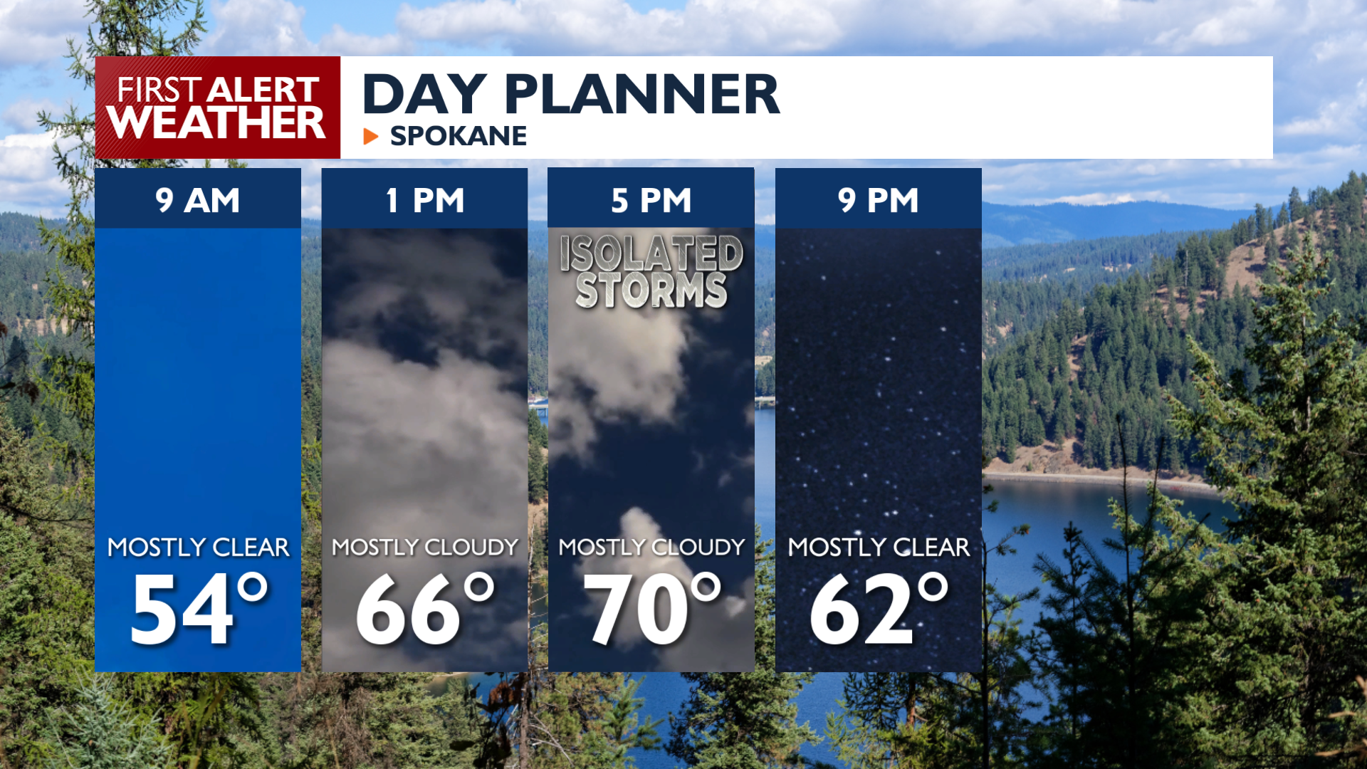
Wednesday afternoon brings a 10 to 30 percent chance of isolated thunderstorms to northeast Washington and north Idaho. These storm cells will be a little more widespread than they were on Tuesday. Expect the best chance to hear thunder in the Spokane area between 1 and 5 p.m.
Temperatures will rise into the low 70s in the I-90 corridor with upper 70s in the Columbia Basin. Fire danger will rise in Central Washington this afternoon thanks to the warm temperatures and a moderate north breeze.
What We’re Tracking
Temperatures warm and conditions stay dry the rest of the week. Saturday and Sunday look excellent for outdoor activities, but the pattern changes on Memorial Day. Cloudy, cool, and stormy conditions on Monday and Tuesday will be a reminder that it’s still springtime.
Extended Forecast
COPYRIGHT 2026 BY KXLY. ALL RIGHTS RESERVED. THIS MATERIAL MAY NOT BE PUBLISHED, BROADCAST, REWRITTEN OR REDISTRIBUTED.
