Hello there—what a difference a week makes. Last week brought widespread snow showers and cool temperatures; this week we’re enjoying unseasonably warm temps and nice conditions. Cooler air is on the way, though.
For your Thursday, expect winds 10–15 mph, with afternoon gusts up to around 20 mph. Highs will reach the mid-60s for much of the region. We’ll see similar conditions tomorrow before cooler temperatures take hold. Thursday is also the final full day of winter, with spring arriving tomorrow around the 10 a.m. hour.
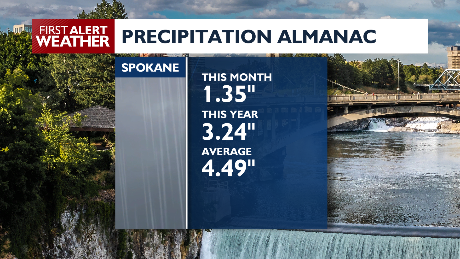
While we’ve had a nice run of precipitation over the past few weeks, we’re still below average for this time of year. Last summer was the driest on record in the region, so we’ll take what we can get. Drought conditions are still present, but they’ve improved significantly compared to last year. Additional rain this spring would help even more.
Over the next seven days, we’ll start with a warm first day of spring on Friday. A cool front arrives late Friday, bringing cooler temperatures for the weekend. Expect 50s to continue into next week, with showers possible Tuesday.
Enjoy your day!
—Jason
COPYRIGHT 2026 BY KXLY. ALL RIGHTS RESERVED. THIS MATERIAL MAY NOT BE PUBLISHED, BROADCAST, REWRITTEN OR REDISTRIBUTED.