We’re finally getting a decent chance to break through the clouds on Tuesday, with a mix of sun and clouds for the rest of the week instead of never-ending gloomy skies.
Plan Your Tuesday
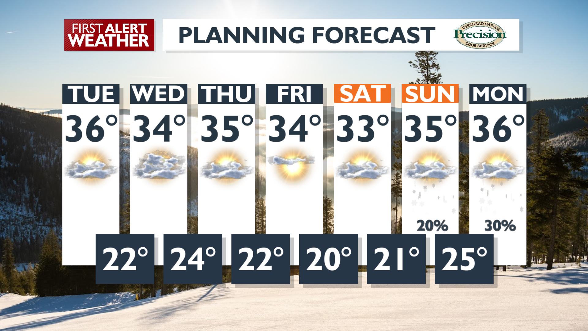
Expect stagnant air with clouds blanketing the lowlands through this morning, but there is a chance these clouds may begin to break up this afternoon as drier air moves in today, potentially bringing some sunshine. Temperatures should remain in the 20s in the morning, with highs in the mid 30s to low 40s where we see the fresh sunshine. Overnight lows will drop quickly with a less-cloudy sky, hitting the low 20s by Wednesday morning.
What We’re Tracking
Highs will be warmer and lows will be colder the rest of this week with more variable cloud coverage. The quiet, dry weather pattern is expected to give way to change by the end of the weekend. A shift to a more west-to-east flow pattern will bring increasing moisture. Precipitation chances increase for the mountains starting Sunday, reaching the lower elevations late Sunday into Monday. Any precipitation accumulation from Sunday through Monday will come as snow and be fairly light, even in the mountains. This could be our only chance for snow until we get closer to February.
Extended Forecast
COPYRIGHT 2025 BY KXLY. ALL RIGHTS RESERVED. THIS MATERIAL MAY NOT BE PUBLISHED, BROADCAST, REWRITTEN OR REDISTRIBUTED.