Today is your last chance to prepare for high winds Tuesday night into Wednesday morning. These winds are capable of causing widespread power outages and tree damage.
Plan your Tuesday
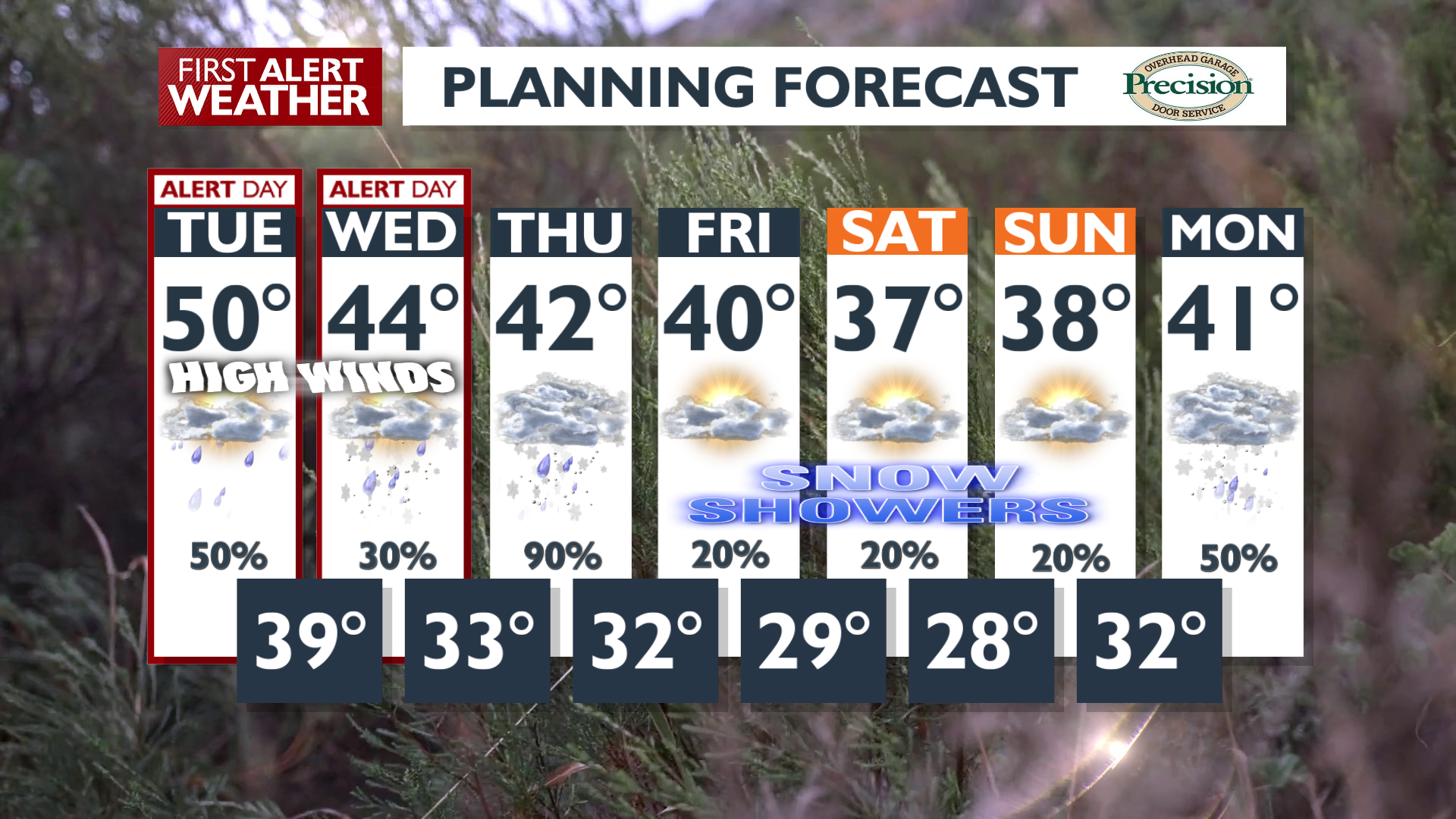
Temperatures won’t be as warm as yesterday, but highs around 50 are still likely this afternoon. Winds will pick up slowly through the day. A High Wind Warning begins at 10 p.m. Today is a Weather Alert Day to remind you to get prepared for the winds coming overnight.
The best chance for rain today will be in our northern valleys. Snow will begin tonight in the Cascades and will be falling fairly constantly for the rest of the week.
What We’re Tracking
Impacts from wind will be significant Tuesday night into Wednesday, where gusts of 60 to 70 mph are possible, especially from Spokane and Coeur d’Alene down into Southeast Washington and the Idaho Palouse. The strongest gusts are likely between 1 a.m. and 6 a.m., followed by long-duration winds greater than 40 mph through early Wednesday afternoon.
Winds like this are likely to cause damage to trees and structures, and could lead to numerous power outages. Prepare for these high winds today by securing or storing objects outside, like holiday decorations or yard equipment. Charge cell phones and find emergency supplies like a flashlight. Park vehicles away from trees.
Mountain areas, particularly the Cascades, will see heavy snow accumulations through Wednesday night, possibly exceeding two feet near the crest with up to a foot around Snoqualmie Pass. Additionally, rain and high mountain snow are fueling concerns for river rises, mud, and rock slides in the Cascades and the Idaho Panhandle through Wednesday morning. Flood Watches remain in effect in these areas.
Extended Forecast
COPYRIGHT 2025 BY KXLY. ALL RIGHTS RESERVED. THIS MATERIAL MAY NOT BE PUBLISHED, BROADCAST, REWRITTEN OR REDISTRIBUTED.