Good Tuesday afternoon!
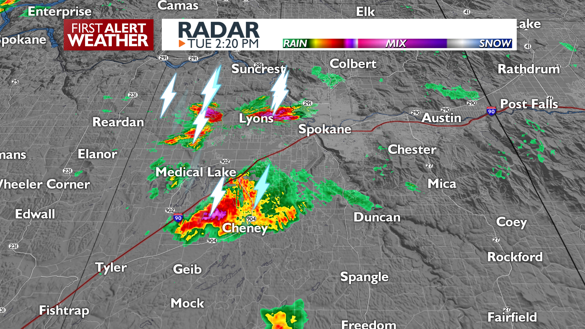
The National Weather Service has issued a Special Weather Statement through 2:45 p.m. Strong thunderstorms are in the area.
Meteorologist Kris Crocker will have more on 4 News Now tonight at 5 and 6 p.m.
From the NWS-
…A strong thunderstorm will impact portions of northwestern Kootenai and east central Spokane Counties through 245 PM PDT… At 216 PM PDT, Doppler radar was tracking a strong thunderstorm over Town And Country, or over Spokane, moving east at 20 mph. HAZARD…Winds in excess of 30 mph. SOURCE…Radar indicated. IMPACT…Gusty winds could knock down tree limbs and blow around unsecured objects. Locations impacted include… Spokane, Spokane Valley, Liberty Lake, Airway Heights, Nine Mile Falls, Millwood, Green Acres, Otis Orchards-East Farms, Trentwood, Fairwood, Country Homes, Town And Country, Otis Orchards, Dishman, Mead, Newman Lake, Opportunity, and Veradale. This includes the following highways… Interstate 90 in Washington between mile markers 275 and 299. Interstate 90 in Idaho near mile marker 0. U.S. Highway 195 in Washington between mile markers 93 and 95. U.S. Highway 395 in Washington between mile markers 165 and 168.
COPYRIGHT 2025 BY KXLY. ALL RIGHTS RESERVED. THIS MATERIAL MAY NOT BE PUBLISHED, BROADCAST, REWRITTEN OR REDISTRIBUTED.