Hello there! The heat is on once again, and with it comes rising fire danger as smoke drifts in and out of our region. While some relief is on the horizon early next week, another round of intense heat is already lining up.
A Heat Advisory is in effect through Monday evening for much of Eastern Washington and parts of the Idaho Panhandle. Expect hot conditions through Monday, with highs in the mid to upper 90s across our region. Southwestern Washington, including the Tri-Cities, is likely to see temperatures climbing into the triple digits.
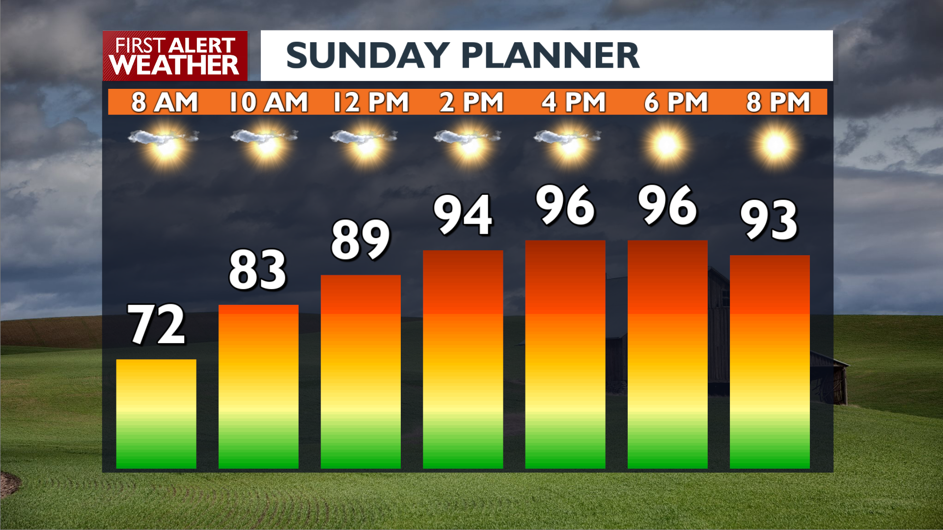
Your Sunday will be hot and mostly beautiful, with occasional breezes. Look for highs in the upper 90s and dry conditions throughout the day. However, moderate fire danger is expected by the afternoon due to low humidity and increasing winds.
On Monday, stronger winds with gusts up to 20 MPH will elevate the fire risk even further, marking a hazardous start to the week.
A big cooldown arrives Tuesday, with temperatures dropping sharply into the low 80s—a welcome break from the heat. But don’t get too comfortable: another heat wave is expected to roll in by the weekend.
Stay safe, stay hydrated, and try to keep cool out there!
– Jason
COPYRIGHT 2025 BY KXLY. ALL RIGHTS RESERVED. THIS MATERIAL MAY NOT BE PUBLISHED, BROADCAST, REWRITTEN OR REDISTRIBUTED.
