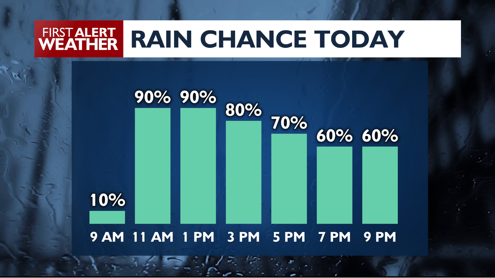
An active weather pattern is here for the start of the workweek. We’ll see rainy weather by the end of the day, with more wet weather and a transition to colder late fall temperatures.
Monday brings a good chance for rain as a storm system moves into the Inland Northwest. Much of the rain today will come from a band of wet weather that will swing through the Spokane and Coeur d’Alene area around midday. Our highest chance of rain will be between 11 a.m. and 3 p.m. Showers will remain a strong possibility through the night into early Tuesday morning. Temperatures won’t move much with the cloudy skies. Lows will be in the low 40s while highs will only reach the low 50s. Snow levels remain high between 5000 and 6000 feet on Monday, but that will soon change.
A colder system arrives Tuesday night through Thursday night, dropping snow levels to between 3000 and 4500 feet. This will bring winter driving conditions to many of our mountain passes later this week. Here are the odds of at least 2 inches of snow for local mountain passes between now and Wednesday night.
Lookout Pass: 65%Snoqualmie Pass: 40%Stevens Pass: 90%North Cascades Highway: 100%Sherman Pass: 40%4th of July Pass: 0%
COPYRIGHT 2026 BY KXLY. ALL RIGHTS RESERVED. THIS MATERIAL MAY NOT BE PUBLISHED, BROADCAST, REWRITTEN OR REDISTRIBUTED.