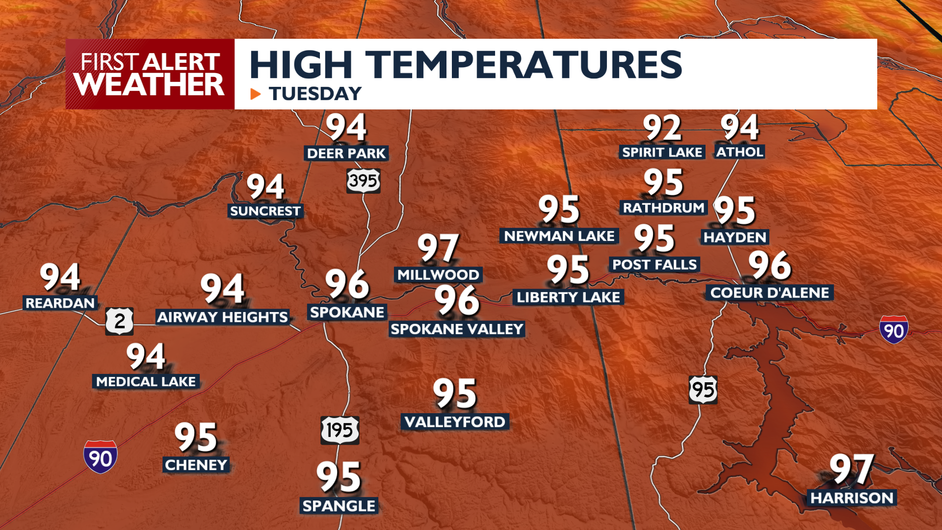
School may be back in session this week, but temperatures for the next couple of days will feel very much like a mid-summer heat wave.
High temperatures Tuesday afternoon will reach the mid to upper 90s across the region, with the L-C Valley peaking between 100 and 103 degrees. A Heat Advisory goes into effect at noon Tuesday and lasts through Wednesday for Lewiston, Clarkston, Lapwai, and Pomeroy.
Isolated thunderstorms could develop late Tuesday evening near the Blue Mountains, moving toward Pullman and Moscow. More isolated storms are possible in Northeast Washington and across the Idaho Panhandle on Wednesday. Any storms will be brief before they track eastward into Montana.
Wednesday remains hot with highs in the 90s, but increasing winds will elevate fire weather concerns for the afternoon in Eastern Washington. By Thursday, a cold front will bring much stronger gusts between 30 and 40 mph and drop temperatures by about 10 degrees. These gusty conditions combined with low humidity will create locally critical fire weather risks before the region cools down further for the weekend.
COPYRIGHT 2026 BY KXLY. ALL RIGHTS RESERVED. THIS MATERIAL MAY NOT BE PUBLISHED, BROADCAST, REWRITTEN OR REDISTRIBUTED.