It’s our last day this week of below-average temperatures, as highs are set to rise quickly through the holiday weekend.
Plan Your Thursday
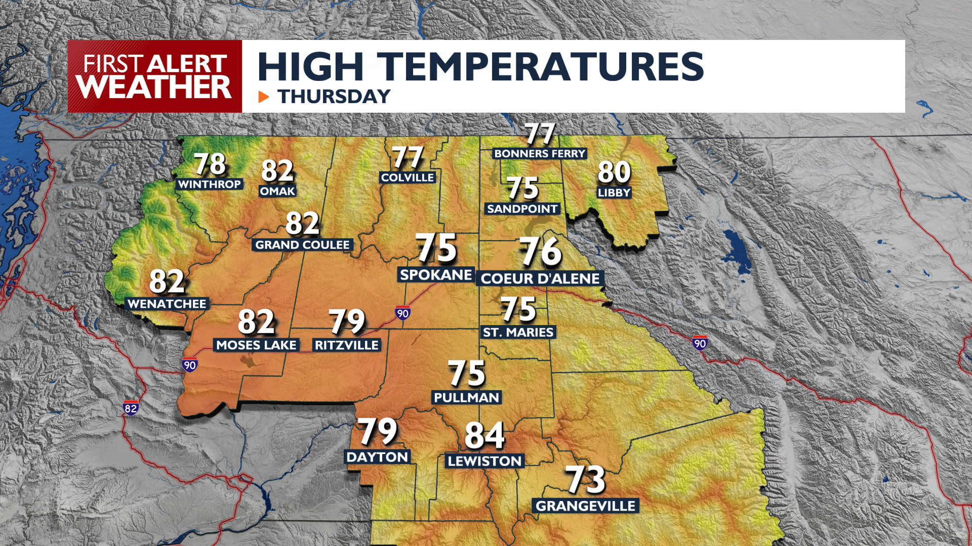
Thursday will be our last day with below-average temperatures, with highs in the mid 70s to low 80s. A fast-moving weather system will brush across our area this afternoon and evening. A few showers are possible in the Okanogan Highlands, North Cascades, Kettle Range, and other areas near the U.S.-Canada border in the evening. Elsewhere, expect increasing clouds as the day goes on.
What We’re Tracking
Warming continues into the weekend while a dry front moves through the region on Saturday. Temperatures will be warmer, humidity will be lower, and winds will gust over 25 mph during the afternoon and evening. Our confidence is growing that this will end up creating critical fire conditions for Independence Day in Central Washington. High pressure then builds early next week, pushing temperatures into the 90s for Monday and Tuesday.
Extended Forecast
COPYRIGHT 2026 BY KXLY. ALL RIGHTS RESERVED. THIS MATERIAL MAY NOT BE PUBLISHED, BROADCAST, REWRITTEN OR REDISTRIBUTED.