Warm weather continues today, but signs will start appearing midweek that will hint at the changes to come this weekend.
Plan Your Tuesday
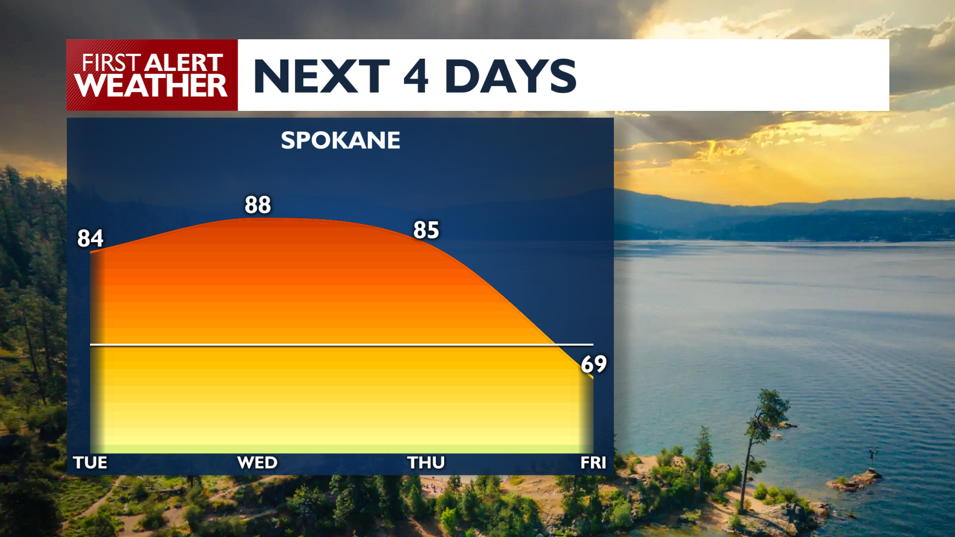
High pressure remains in control through Tuesday Night, keeping conditions warm and mostly dry. Afternoon highs on Tuesday will climb into the mid 80s and lower 90s with light winds and partly cloudy skies. There is a small chance of a couple of showers or thunderstorms over the Cascades and northern mountains during the late afternoon.
What We’re Tracking
Mountain showers and storms become more common on Wednesday and Thursday, while afternoon winds pick up ahead of the next storm system. Temperatures will stay well above average during this period, from the mid 80s to the low 90s.
The next storm system arrives on Friday with a chance for widespread showers and thunderstorms. Temperatures will crash to the 60s and 70s through the weekend while showers remain in the area through Monday.
Extended Forecast
COPYRIGHT 2026 BY KXLY. ALL RIGHTS RESERVED. THIS MATERIAL MAY NOT BE PUBLISHED, BROADCAST, REWRITTEN OR REDISTRIBUTED.