Tuesday will remain on the calm side with a mix of sun and clouds before a stronger storm system brings rain, mountain snow, and breezy winds starting tonight.
Plan Your Tuesday
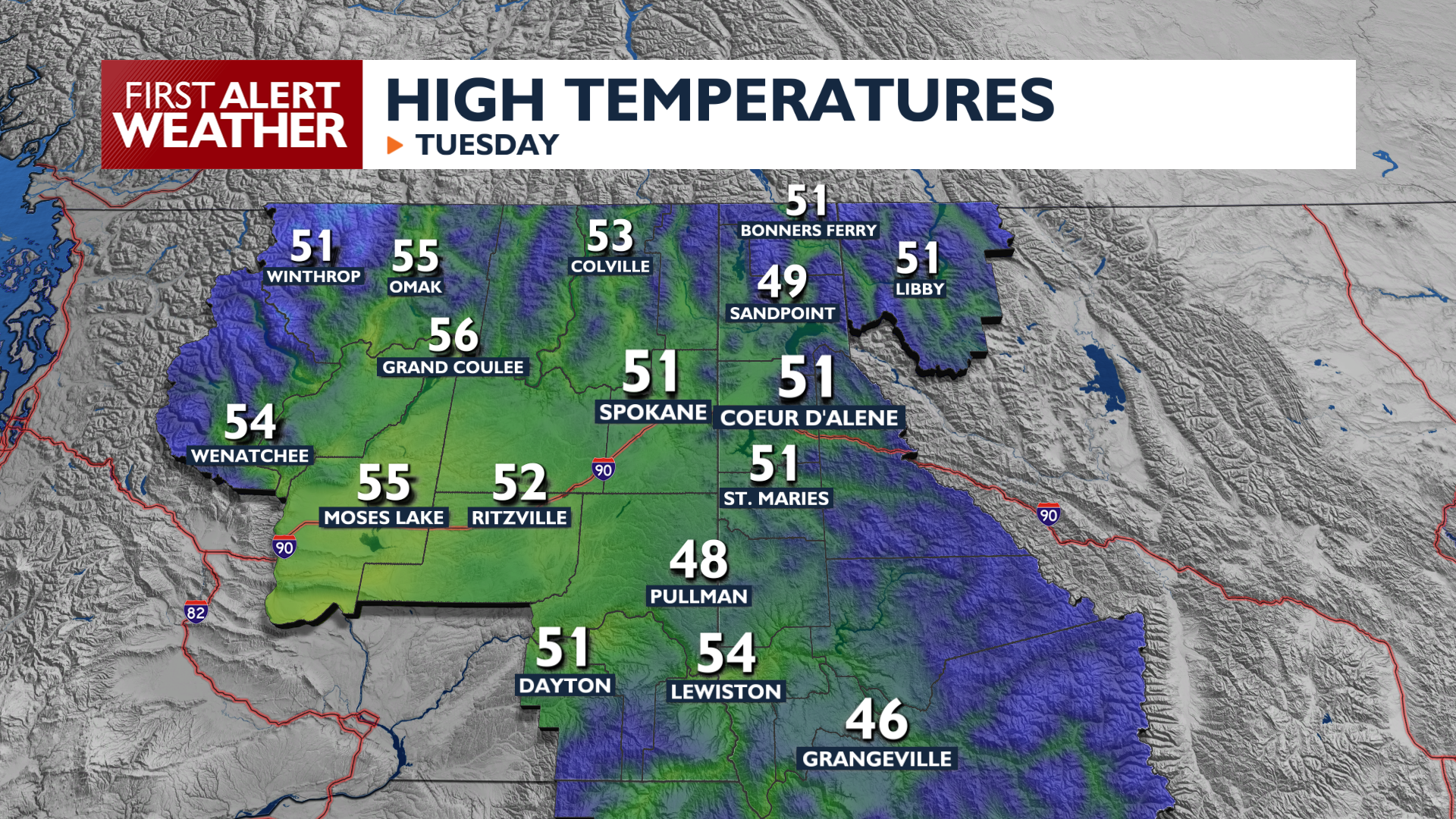
Tuesday brings quiet weather with increasing clouds as moisture moves in from the south. Afternoon highs will reach the upper 40s to mid 50s with calm winds across the region. A few rain showers are possible south of I-90 late in the day, and rain and/or mixed precipitation chances start to increase after midnight.
What We’re Tracking
Widespread rain and mountain snow arrive on Wednesday. Most areas will see between a quarter-inch and a half-inch of rain, while mountain passes will get 3 to as much as 8 inches of snow. Snow or a winter mix is possible in our northern valleys on Wednesday morning and region-wide on Thursday. Any valley accumulations will be minimal. Creeks and streams in Southeast Washington and North-Central Idaho could rise quickly late in the week and lead to more flooding.
A significant warming trend begins Friday with temperatures flirting with the 70s by early next week.
Extended Forecast
COPYRIGHT 2026 BY KXLY. ALL RIGHTS RESERVED. THIS MATERIAL MAY NOT BE PUBLISHED, BROADCAST, REWRITTEN OR REDISTRIBUTED.
