Friday brings more winds and a little mountain snow before a warming trend takes over for the weekend and early next week.
Plan Your Friday
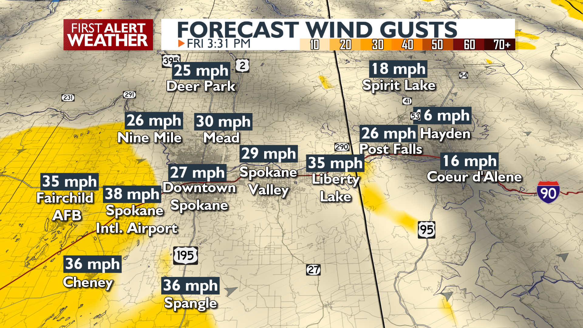
It’ll be windy for a third straight day, gusting between 30 and 40 mph across the Columbia Basin and up to 30 mph elsewhere. Light snow is expected in the mountains with a little slush possible around Lookout, Snoqualmie, and Stevens Passes.
Despite it being a cloudier day than Thursday was, temperatures will be just as warm, maybe even a little warmer, in the upper 40s and low 50s. Clouds clear and winds calm overnight.
What We’re Tracking
A significant warming trend begins Saturday and continues through Tuesday as afternoon highs climb into the 50s and even touch the 60s in the LC Valley. Mid 50s are a strong possibility by Monday or Tuesday around Spokane and Coeur d’Alene. This stretch of dry weather ends Wednesday when the next storm arrives with valley rain and mountain snow.
Extended Forecast
COPYRIGHT 2026 BY KXLY. ALL RIGHTS RESERVED. THIS MATERIAL MAY NOT BE PUBLISHED, BROADCAST, REWRITTEN OR REDISTRIBUTED.
