Cold, dry conditions continue through Tuesday before a warmer, wetter pattern brings chances for rain and snow to finish up the workweek.
Plan Your Monday
It will continue to be dry and cold on Monday, with highs only reaching the low 30s. Sunshine will be partially obscured by middle and high-level clouds. Clouds will increase during the day before clearing out later this evening, leading into a quiet, chilly night.
What We’re Tracking
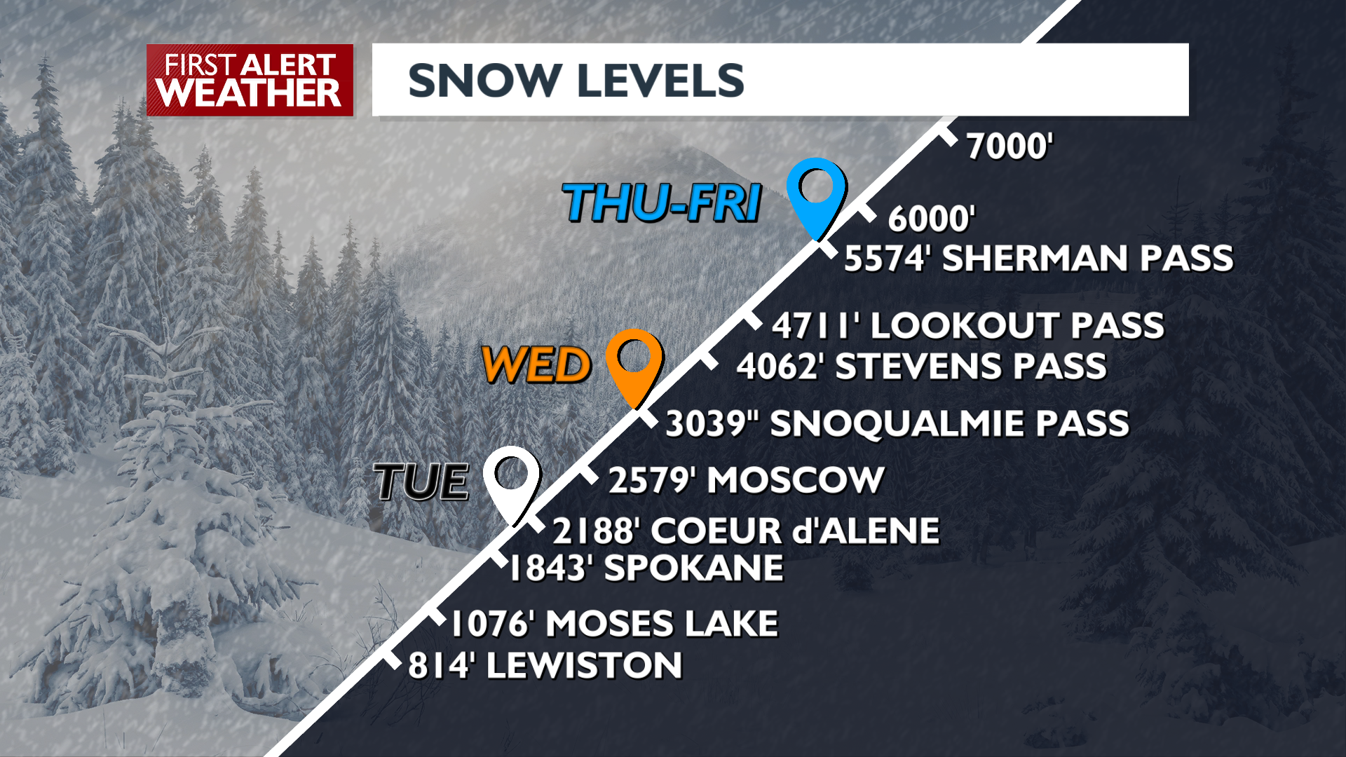
The pattern shifts starting Wednesday as a broad region of storminess brings warmer and wetter conditions. Mountain snow and some valley winter mix will be possible early Wednesday. From Thursday onward, snow levels rise to over 5000 feet, eliminating the chance for snow in the lowlands and bringing a rain/snow mix up to the passes. Rain chances will be on the high end Thursday and Friday, with lower odds this weekend.
Extended Forecast
COPYRIGHT 2025 BY KXLY. ALL RIGHTS RESERVED. THIS MATERIAL MAY NOT BE PUBLISHED, BROADCAST, REWRITTEN OR REDISTRIBUTED.