Low clouds are breaking up as much drier air moves in this morning, leading to so much-needed sunshine today. Even with the sun, expect colder temperatures throughout this weekend.
Plan Your Friday
The low clouds and lingering moisture will be scrubbed out today thanks to a bone-dry northeast wind. Clouds will still be lingering in Southeast Washington, the Okanogan Highlands, and the Columbia Basin in the morning. The clearing will reach the east slopes of the Cascades in the afternoon. Winds will be a bit brisk, sustained around 10 to 15 mph with gusts near 20 mph. You’ll want some warm layers out there, even with the sunshine.
What We’re Tracking
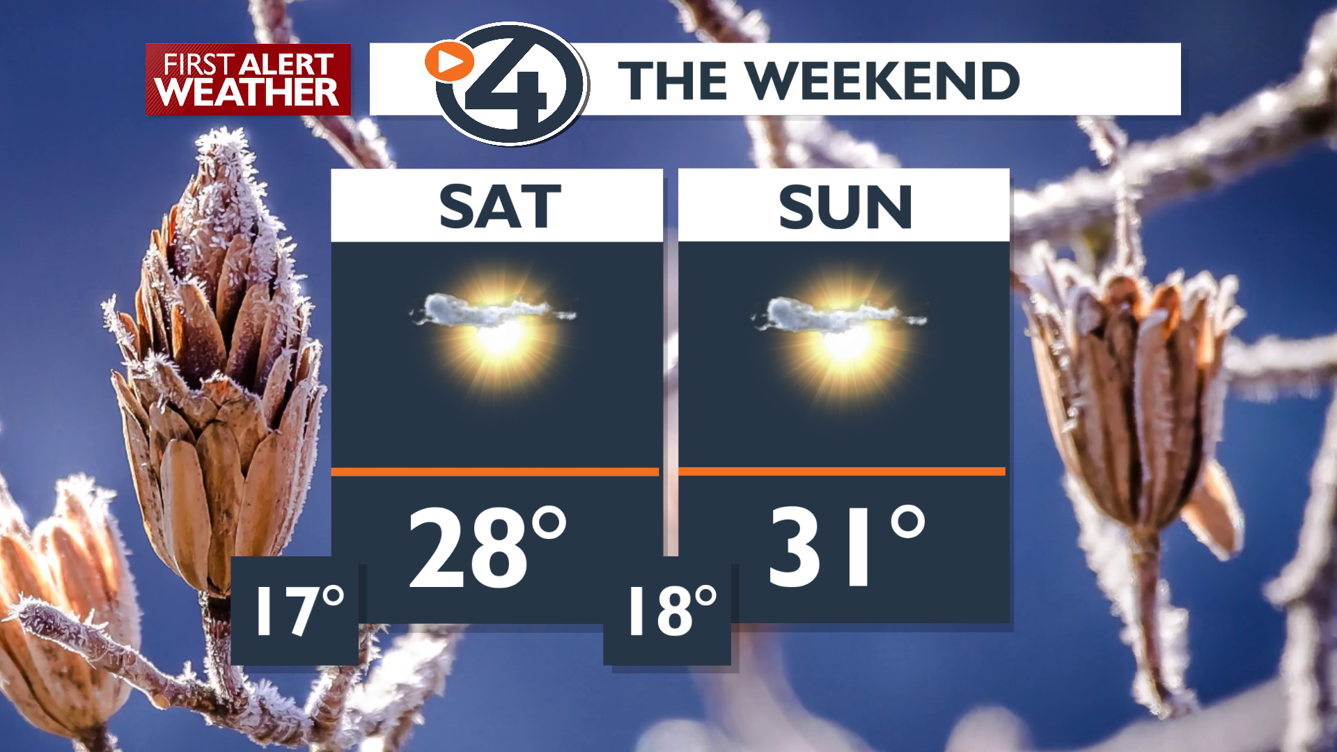
Skies are set to remain clear through the upcoming weekend. Due to clear skies and weak winds, nighttime cooling will be fast, pushing lows Saturday and Sunday mornings into the teens. In the Spokane and Coeur d’Alene area, lows in the teens will be among the coldest nights we’ve seen so far during this mild winter.
Next week, a ridge of high pressure builds, keeping the area dry. A slow warming trend will build us back toward warm winter temperatures by the middle of the week, along with a slight chance of precipitation.
Extended Forecast
COPYRIGHT 2025 BY KXLY. ALL RIGHTS RESERVED. THIS MATERIAL MAY NOT BE PUBLISHED, BROADCAST, REWRITTEN OR REDISTRIBUTED.
