Cloudy skies persist across the lowlands on Martin Luther King Jr. Day, while higher terrain remains mostly sunny under a stagnant high-pressure pattern.
Plan your Monday
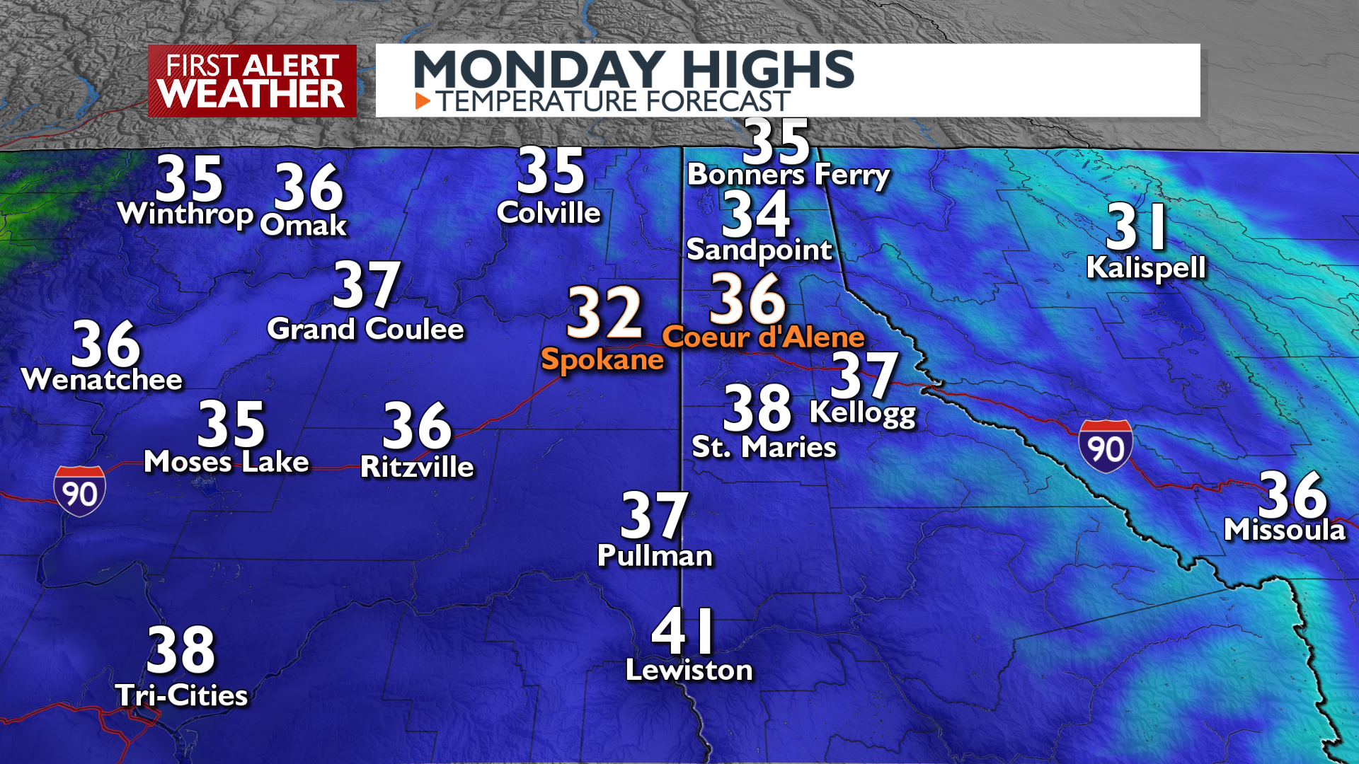
Expect persistent low clouds to continue today. High terrain areas will experience mostly sunny skies. We’ll struggle to get above freezing around the lowlands today, while mountain highs hit the 40s. Overnight lows will settle into the upper 20s to 30s. An Air Stagnation Advisory remains in effect until Tuesday afternoon.
There’s a good chance of seeing the Northern Lights tonight, as long as you make an effort to get above the cloud layer. It will be extremely difficult for most of us to see anything.
What We’re Tracking
Tuesday could finally be the day we break out from underneath the deck of stratus clouds that have been here for almost a week now. Slightly cooler, drier air will swing in from a system over the Northern Plains. This could promote a few snow flurries in the North Idaho mountains but more importantly it should drop the humidity enough to eat into the stratus deck which will help break up the valley/lowland inversions. Nights will get colder and afternoons will be warmer after Tuesday, but the overall pattern remains fairly quiet. That has a chance to change this weekend with the possibility of some snow on Sunday evening.
Extended Forecast
COPYRIGHT 2025 BY KXLY. ALL RIGHTS RESERVED. THIS MATERIAL MAY NOT BE PUBLISHED, BROADCAST, REWRITTEN OR REDISTRIBUTED.
