It sure didn’t feel like January yesterday, and it won’t feel like winter on Tuesday either. This brief warm stretch is coming to an end soon. Gloomy low clouds and fog are in the forecast.
Plan Your Tuesday
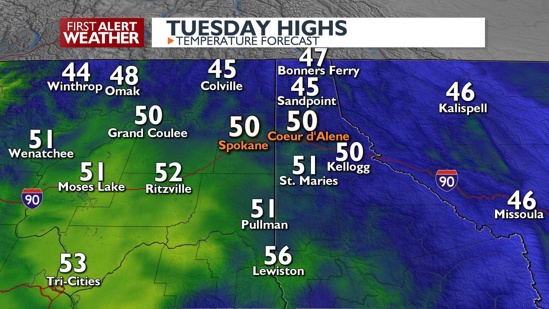
Light rain showers are still possible across the North Cascades, Northeast Washington, and North Idaho areas this morning, but any rain chance will fade rapidly as we approach midday. High temperatures will be in the 40s and low 50s across the area, just shy of records. There will be a higher chance for a little bit of sunshine in the afternoon as well. Temperatures drop quickly this evening and fog will start to develop around the region heading into early Wednesday morning.
What We’re Tracking
A strong ridge of high pressure is building in and will keep conditions mainly dry from mid-week through the weekend. We’ll see warm afternoons up in the mountains and at local ski areas, along with lots of sunshine. Meanwhile, valley temperature inversions will establish low clouds and fog in the valleys across much of the Inland Northwest on Wednesday and Thursday. This winter gloom will continue until at least Saturday. The movement of the high pressure ridge over the weekend may allow the inversions to break up by Sunday or Monday.
Extended Forecast
COPYRIGHT 2025 BY KXLY. ALL RIGHTS RESERVED. THIS MATERIAL MAY NOT BE PUBLISHED, BROADCAST, REWRITTEN OR REDISTRIBUTED.