Hello there, and Happy Friday! Welcome to the weekend. After a snowy and chilly week, we’re starting to see some changes as drier conditions move in today.
Friday will be a bit warmer, with mostly cloudy skies and light winds throughout the area. Some morning freezing fog and a possible flurry or two will give way to afternoon sunshine, with highs reaching the mid to upper 30s. Today marks the beginning of a stretch of above-freezing temperatures.
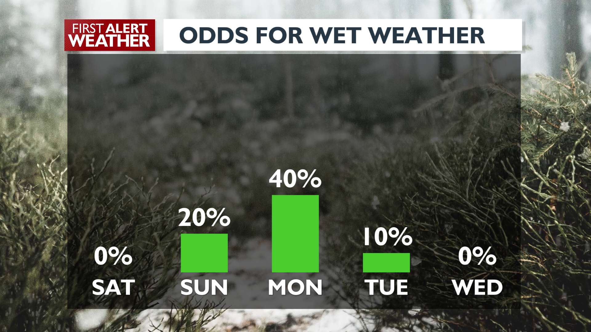
We’ll also experience much drier weather over the next few days. Spokane might see a few early rain showers on Sunday, with a better chance of sustained showers on Monday. The southeast corner of Washington and the northern panhandle of Idaho could see some light snow on Sunday.
Looking ahead to the week, warmer conditions will take hold, with temperatures running 10 to 15 degrees above average for the workweek. Expect highs in the mid to upper 40s, and above-freezing temperatures overnight starting late Sunday. Most of the snow on the ground should be gone by next week.
Enjoy your weekend!
-Jason
COPYRIGHT 2025 BY KXLY. ALL RIGHTS RESERVED. THIS MATERIAL MAY NOT BE PUBLISHED, BROADCAST, REWRITTEN OR REDISTRIBUTED.