Valleys and lowlands get a break from snow and rain for most of the day, but the mountains will keep getting dumped on. The next round of snow arrives this evening.
PLAN MY DAY
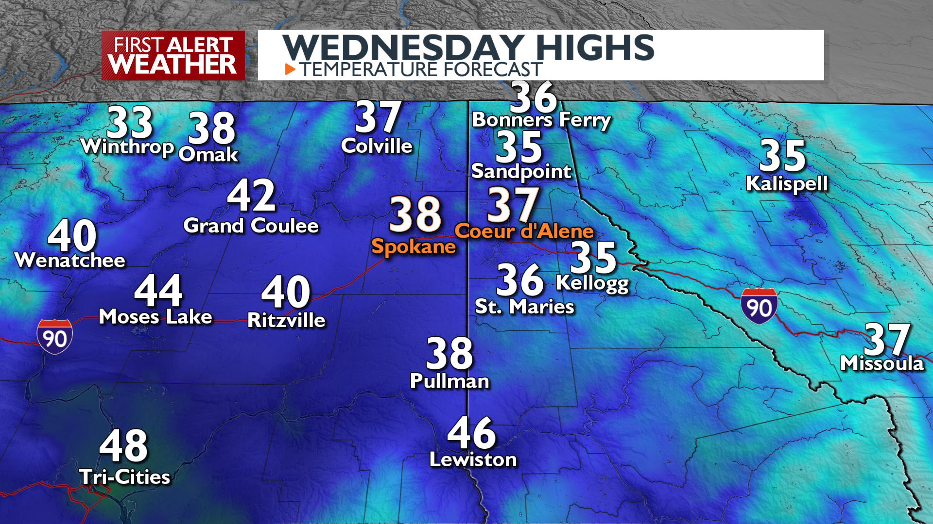
Midday and the afternoon will be largely dry with a mix of sun and clouds and continued gusty winds at times. Temperatures will be quite mild for this time of year, especially in the Columbia Basin.
A second, less intense storm system arrives late this afternoon, bringing more snow. Most of this new snow will show up after the evening commute, which will begin a period of cooler temperatures and slick roads that could last into tomorrow morning.
WHAT WE’RE TRACKING
Snow showers continue through the night and Thursday morning. Expect light amounts under 3 inches in the valleys and up to 7 inches in the mountains. Snoqualmie and Stevens passes will see more significant snow and traffic slowdowns.
The weather shifts on Friday with an upper-level ridge bringing drier and warmer conditions through the weekend. Lingering mountain precipitation should clear by Friday morning. This dry, mild pattern appears to continue for a while past the weekend.
EXTENDED FORECAST
COPYRIGHT 2025 BY KXLY. ALL RIGHTS RESERVED. THIS MATERIAL MAY NOT BE PUBLISHED, BROADCAST, REWRITTEN OR REDISTRIBUTED.