Air Stagnation Advisories are in effect through midday Thursday, followed by a potential lowland wintry mix late Thursday and Friday across parts of Washington and Idaho.
Plan your Tuesday
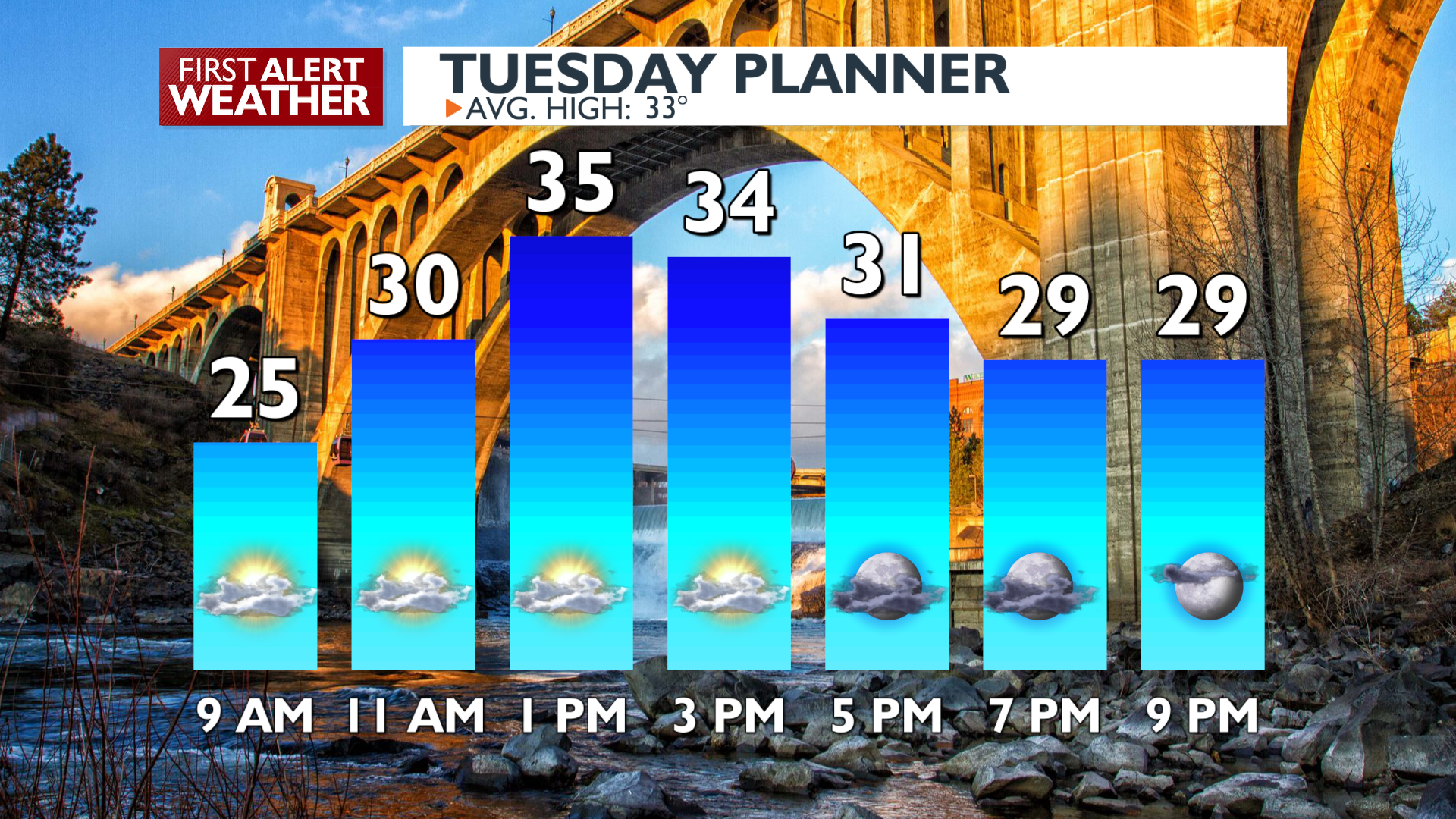
An Air Stagnation Advisory is currently in effect for much of North and Central Idaho and parts of Eastern Washington until noon on Thursday. Our air is quite still, and pollutants will be trapped near the ground for the next couple of days, which could lower the air quality. Expect the AQI to hover in the moderate range for most of Tuesday, Wednesday, and Thursday. Even with inversions in place, temperatures will pop up above average this afternoon, reaching the mid-30s, along with more pleasant winter sunshine.
What We’re Tracking
Unsettled conditions are expected to arrive by Thursday evening. There is significant uncertainty regarding precipitation type in the valleys, but a wintry mix looks plausible on Friday morning before transitioning to rain. The best chances for any lowland snow accumulation will be near the Canadian border and the east slopes of the Cascades. Pockets of freezing rain will be possible Thursday night and Friday morning in Eastern Washington.
Any remaining lowland snow is expected to change to rain by Friday afternoon as temperatures continue to warm. One positive aspect is that the mountains will continue to receive snow during this active stretch of weather, which is expected to last for most of next week.
Extended Forecast
COPYRIGHT 2025 BY KXLY. ALL RIGHTS RESERVED. THIS MATERIAL MAY NOT BE PUBLISHED, BROADCAST, REWRITTEN OR REDISTRIBUTED.