It will be breezy, sunny, and chilly throughout Friday. In the mountains, heavy snow will lead to hazardous travel conditions over the mountain passes.
Plan your Friday
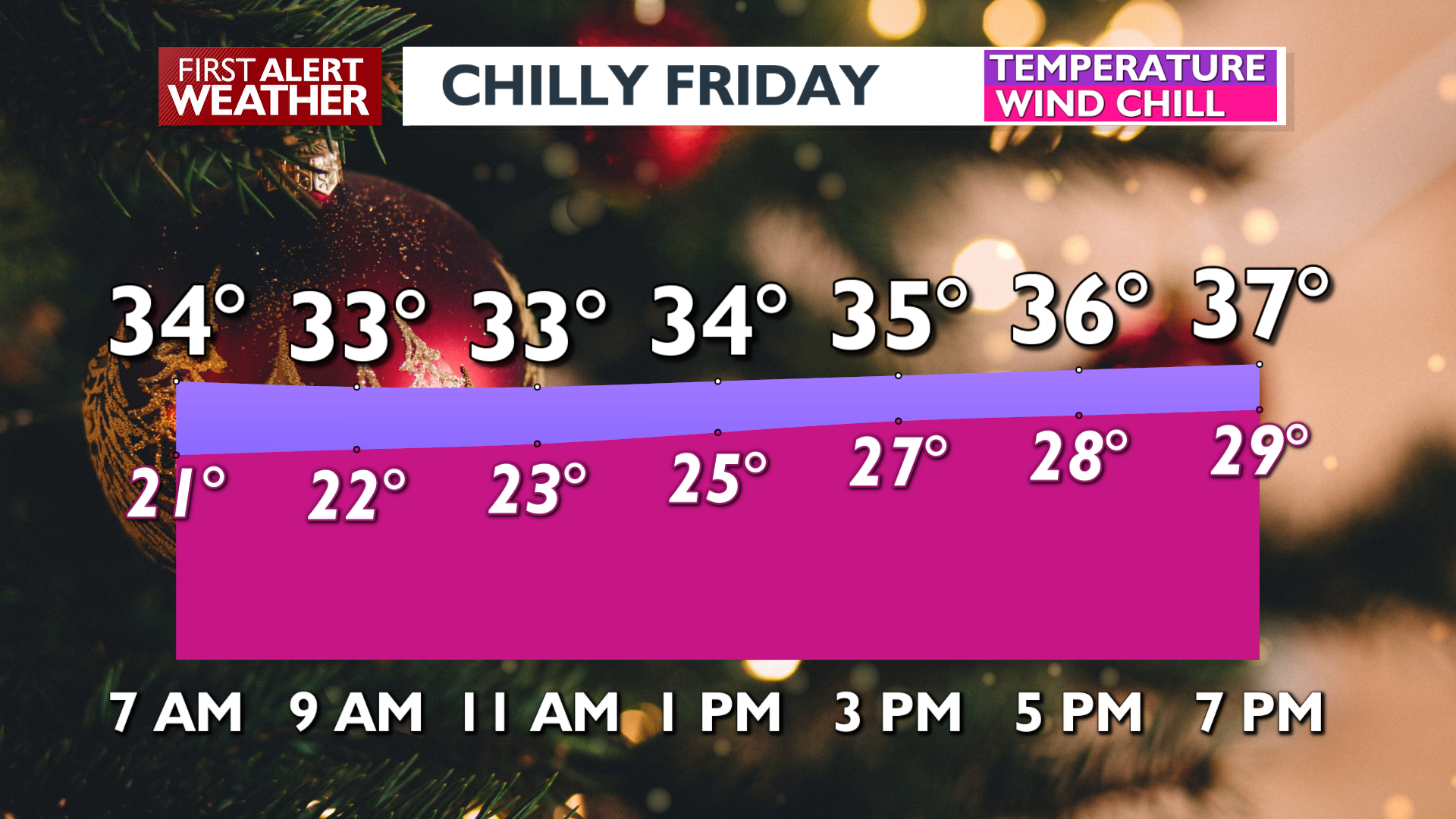
A cold front passed early this morning, and while the strongest winds happened last night, we’ll still see conditions be a a little breezy through the entire day. Highs will be in the upper 30s today but the breeze will make wind chill feel like the 20s when there’s a gust. Gusts will only be 25-35 mph. While most lowlands will remain dry due to a rain shadow effect, a few snow flurries will be possible late in the day.
What We’re Tracking
The Cascades and the Northern Rockies/Idaho Panhandle mountains will see almost constant moderate to heavy snow showers today. This pattern continues into the weekend and will set up some large snow totals by Sunday night. Multiple feet of snow will fall over Snoqualmie Pass, and travel will become extremely difficult at times.
Light snow showers are possible on Saturday. Valleys in North Idaho and Northeast Washington will occasionally see some of this snow stick, especially late Saturday into early Sunday. Temperatures warm to a rain/snow mix for valleys late Sunday, and we’ll flip-flop back and forth at times to start the Christmas holiday week.
Extended Forecast
COPYRIGHT 2025 BY KXLY. ALL RIGHTS RESERVED. THIS MATERIAL MAY NOT BE PUBLISHED, BROADCAST, REWRITTEN OR REDISTRIBUTED.
