Your day might not start with rain, but it will finish that way. Thursday will be the wettest day of the week around the Inland Northwest.
Plan Your Thursday
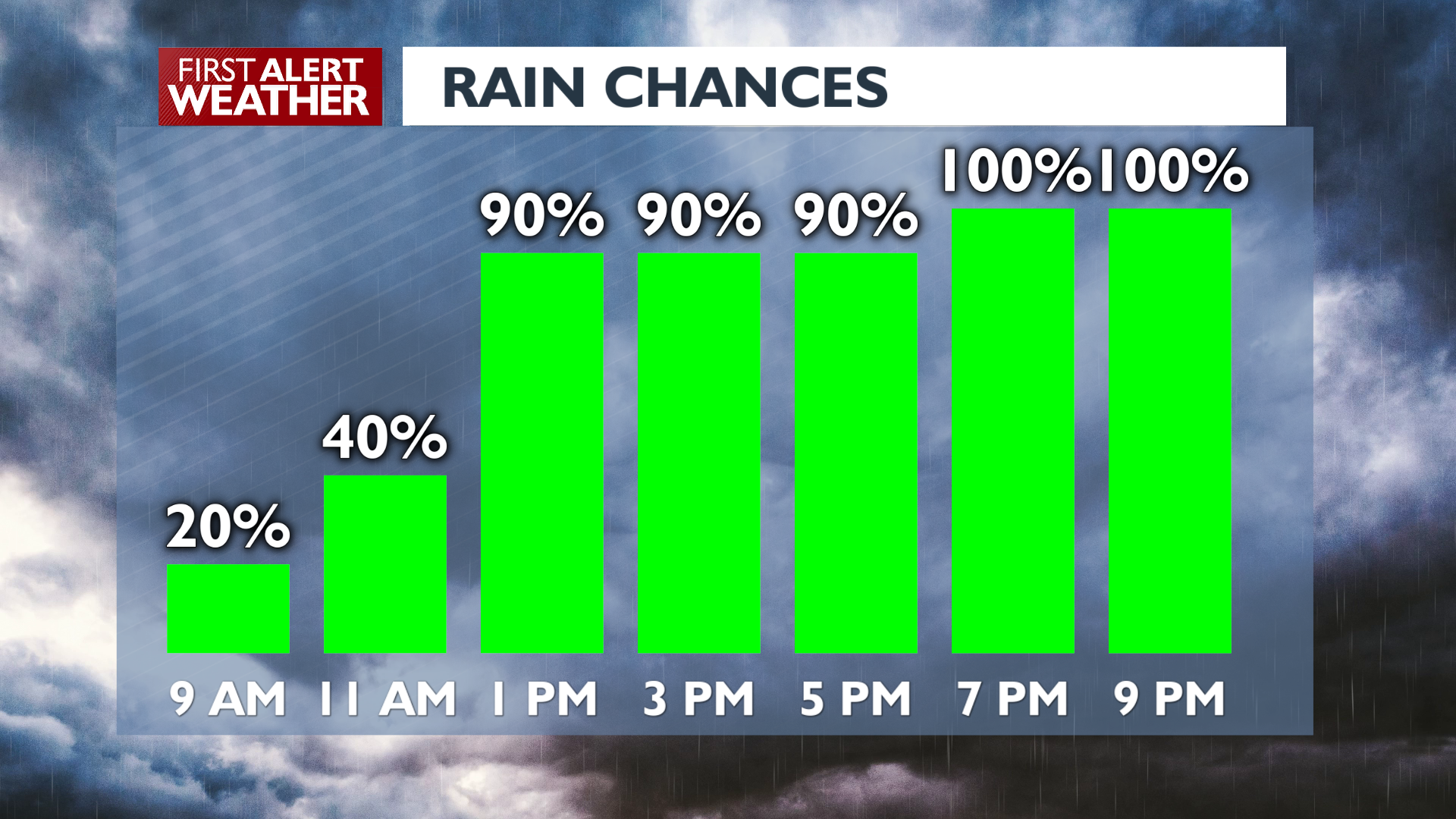
Expect conditions to become breezier and wetter through the end of the day and last through the night into Friday. Rain is most likely near the Cascades and northern valleys this morning and will expand to region-wide soggy weather this afternoon. Expect rain to start coming in steady around lunchtime in Spokane and Coeur d’Alene.
Snow levels remain above the major mountain passes today. Gusty southerly winds over 30 mph are possible, mainly across the Palouse and Southeast Washington.
What We’re Tracking
The weekend starts with a weak ridge building in Saturday which should keep us dry more of then than not. Another weather system arrives late Sunday into early Monday, bringing more light rain and eventually lowering snow levels significantly. Mountain pass snow and even some higher elevation valleys could see snow mixed in with rain Monday night. More wet weather is likely on Wednesday with another shot of cold air. Any wet weather in the middle of next week would have a significantly higher chance of becoming at least a rain/snow mix in the lower elevations.
Extended Forecast
COPYRIGHT 2025 BY KXLY. ALL RIGHTS RESERVED. THIS MATERIAL MAY NOT BE PUBLISHED, BROADCAST, REWRITTEN OR REDISTRIBUTED.
