Gusty winds, widespread rain, and mountain snow will create less than ideal conditions for travel and outdoor activities across the region this weekend. Be prepared for fast-changing weather over the next few days.
What We’re Tracking
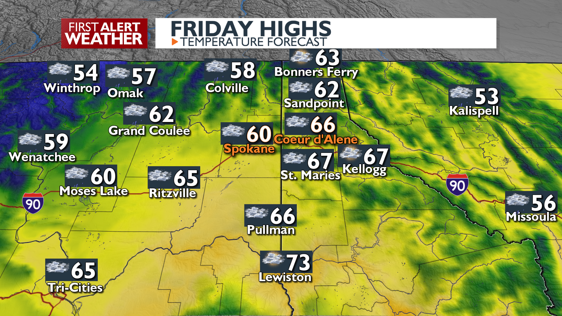
Today: We’ll see the sky remain cloudy as we wait for the wet weather to arrive. Winds will pick up in the late afternoon, and rain will appear in the late afternoon or early evening in Spokane and Coeur d’Alene. A Wind Advisory is in effect for brief gusts of 30 to 45 mph as this first round of rain passes. Temperatures will stay mild today in the low 60s.
Saturday: Rain eases up overnight and patchy fog is likely in the morning. Rain and wind will ramp up again during the afternoon. The atmosphere will be energetic enough that we may see a few lightning strikes on Saturday evening in Southeast Washington. Snow levels will start dropping Saturday night, so be prepared for snowy pass travel after midnight.
Sunday: It’s all about mountain snow to end the weekend. Heavy snow will fall over Stevens Pass while snow or a rain/snow mix will fall over other passes in our region. Expect winter travel conditions, especially in the morning. Scattered showers continue on Sunday while winds won’t be as strong as Saturday. It will be much cooler with highs only in the 40s.
Plan your Friday + Weekend
Extended Forecast
COPYRIGHT 2025 BY KXLY. ALL RIGHTS RESERVED. THIS MATERIAL MAY NOT BE PUBLISHED, BROADCAST, REWRITTEN OR REDISTRIBUTED.
