After some afternoon sunshine, another round of rain is expected to arrive tonight as we continue to feel a cooling trend.
What We’re Tracking
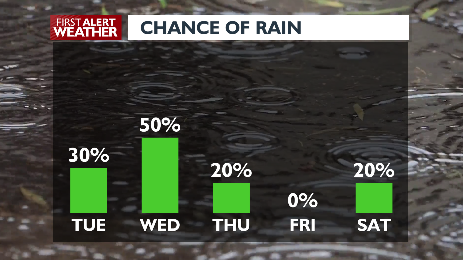
Showers in the region will mostly disappear after mid-morning, leaving conditions dry and comfortable in the 60s for the afternoon. One exception to the drier weather will be a few isolated showers and/or storms around the Palouse and the central Idaho Panhandle during the afternoon hours. Another round of rain moves in late this evening, and scattered showers stick around on Wednesday and through Thursday morning. With the wet weather, we should be on the lookout for fog in the morning as well.
Temperatures will continue to cool through midweek, with highs only in the mid-60s starting Wednesday through this weekend. Lows will drop to the mid-40s. Dry weather returns late Thursday and could stick around for a while.
Plan your Tuesday
Radar: Afternoon
Radar: Late Evening
Extended Forecast
COPYRIGHT 2025 BY KXLY. ALL RIGHTS RESERVED. THIS MATERIAL MAY NOT BE PUBLISHED, BROADCAST, REWRITTEN OR REDISTRIBUTED.
