SPOKANE, Wash. — A fast-growing fire cast a long shadow across the Inland Northwest. Framed by the setting sun, a 4 News Now viewer in Colbert captured the gigantic plume of smoke and cloud on Tuesday evening.
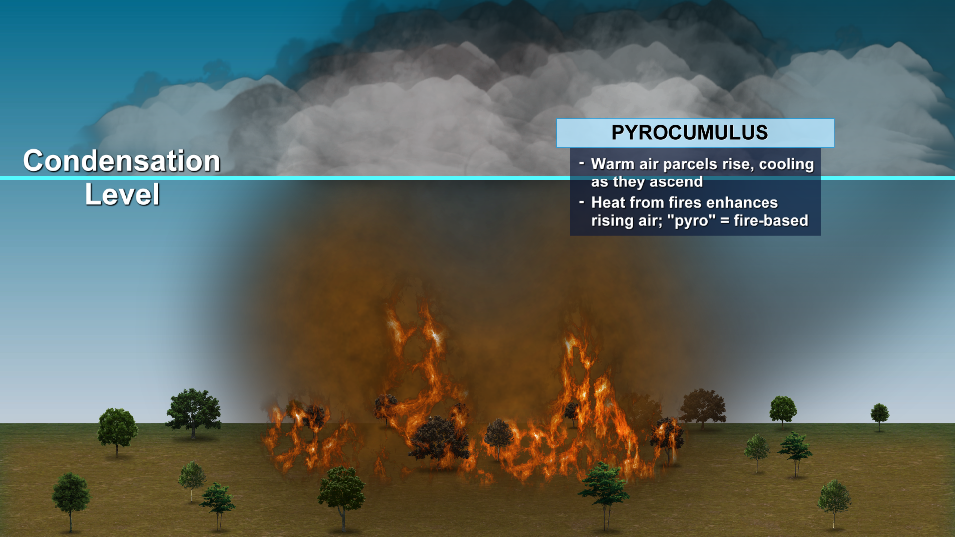
The top section of this plume is what’s called a pyrocumulus cloud (pyro meaning fire). It is an actual cloud formed by the smoke and fire below it. The intense heat from the fire and smoke particles rising into the sky helps to condense water vapor efficiently, even in what is otherwise a dry atmosphere.
In the most extreme cases, these clouds can become pyrocumulonimbus clouds and produce strong winds and lightning. According to the National Weather Service, the top of this cloud reached 35,000 feet high.
In other words, the fire is creating its own weather above it. Satellite views from above were able to capture the cloud forming above the smoke as the sun set on Tuesday.
The fire that caused this pyrocumulus is called the Rattlesnake Fire, about 30 miles south of Inchelium in Ferry County, across Lake Roosevelt from the communities of Lincoln and Fort Spokane. The fire is 4210 acres in size and 0% contained. It is just one of many fires that are either new or have “woken up” and resumed actively burning with lots of smoke production.
Air Quality Alerts are in effect around Eastern Washington, and a Fire Weather Warning is up for extreme fire behavior in Northeastern Washington.
Track the latest on fires in our region from the 4 News Now Firewatch page.
COPYRIGHT 2025 BY KXLY. ALL RIGHTS RESERVED. THIS MATERIAL MAY NOT BE PUBLISHED, BROADCAST, REWRITTEN OR REDISTRIBUTED.